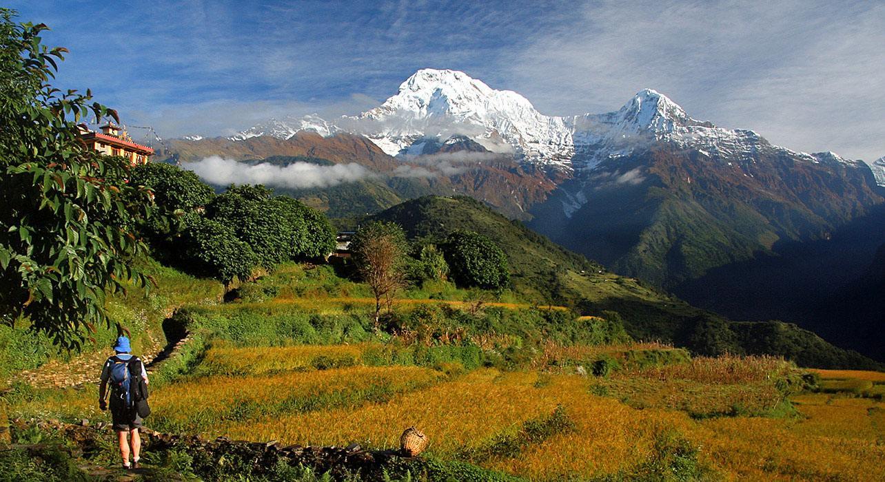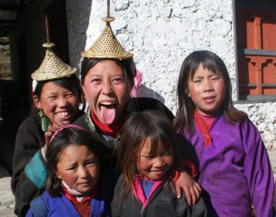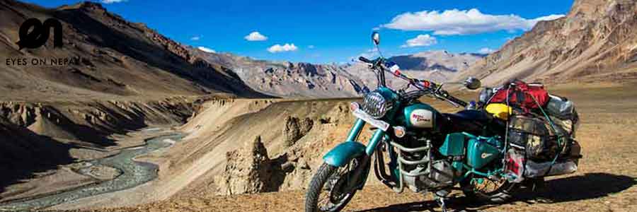
The ancient kingdom of Mustang was attached to Tibet in the 14th century although it remained an autonomous dynasty. Later it was annexed by Nepal, but the people still remain predominantly Tibetan. Untouched by the outside world or the Chinese Cultural Revolution, 16th century monasteries still remain active to preserve this magnificent trans-Himalayan kingdom, with their unrivalled Thangkas, Mandalas and deities.A journey to Mustang is a journey of remarkable contrasts. In this wild landscape of unreal colour and beauty, ruggedly carved mountains reach up to deep blue skies, while icy peaks glimmer majestically to the south. Vast and barren ridges extend to the northern horizon making one feel like an insignificant dot on a timeless landscape.The high desert region of the Tibetan influence, Kaligandaki, from the Tibetan border south to Kagbeni is generally referred to as Upper Mustang. Explore the thousand years of old monastery, caves, local tribes and scenic beauties of the different landscapes. Make an adventure starting from world’s deepest gorge Kaligandaki Region into world’s highest regions of Lo-Mangthang Valley.The Transhimalayan Mustang Region is also known as the Last Forbidden Kingdom, since the region was restricted for outsiders until Nepal Government announced the opening of the restricted areas in October 1991.The region preserves its own history and rich culture.
Upon arrival in Kathmandu, you will be met by our Himalayan Hikers representative and transferred you to the hotel. The drive from the airport to the hotel is around 20 minutes.After your checkin the group leader will set a time for your trek briefing to discuss in regards to the trek. The evening is free but your trek leader will organise a welcome dinner at a fine local restaurant.
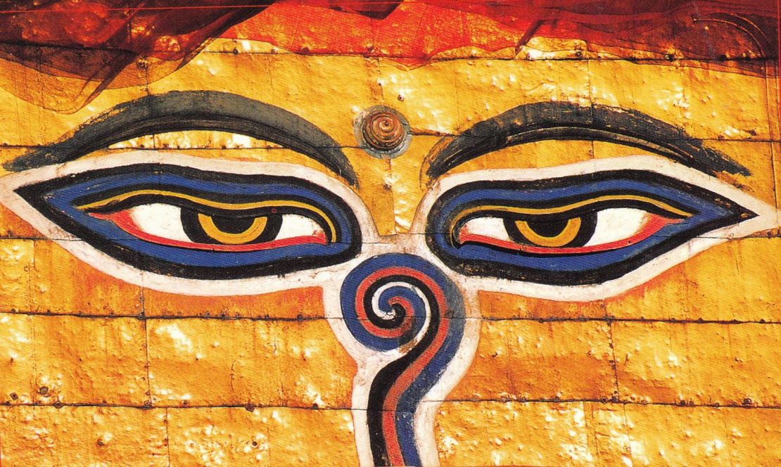
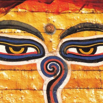
Today, you will visit Bodhnath Stupa, one of the biggest Buddhist shrines in the world and Pashupatinath ,the main temple for the hindus. Here you will see Hindu holy men (sadhus) meditating, pilgrims bathing, and occasionally funeral pyres burning on the ghats. The rest of your afternoon is free. In the late afternoon you will be issued with your trek. Departure information for the next morning will also be given. Meals included: B
Transfer to the domestic terminal and fly to Pokhara, with a flight time of about 30 minutes. There are spectacular views of the main Himalayan chain to the north, including the 8000 metre peaks of Manaslu and Annapurna during this short flight.On reaching Pokhara we are transferred to the hotel situated on the main lakeside area.After your checkin you have free time to explore this beautiful town of pokhara. Your leader will be on hand for any assistance required. Meals included: B, L, D
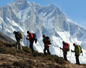
After a breathtaking morning flight for 20 minutes it is necessary to spend some time in Jomsom (administrative headquarter of Mustang Disrict), while the trek staff sort out the loads. You will also need to relax a little and begin to acclimatize to the altitude. The trek begins by crossing the bridge north of the airstrip to the old part of Jomsom. The trail now heads north on the east bank of the wide stony Kali Gandaki. Expect for a high windy trail if walking in the afternoon. Keeping on the east side, continue past the side valley of the Panga Khola (stream) and around a bluff to the small settlement of Eklobhatti. From here another bend in the river takes you to Kagbeniand entry to the forbidden land. Meals included: B, L, D
Having completed the formalities, proceed out of Kagbeni north past the mani wall and iricheck point. At last you could venture beyond the sign forbidding tourists to pass this point, and the real adventure began. Almost immediately the path climbs quite steeply up into a jumble of gullies and small towers, zigzagging to a viewpoint over Kagbeni with Nilgiri. After a few more ups and downs the trail climbs to a plateau at 3040 m, then drops steeply into a dry river bed. Its then a short climb to Tangbe at 3060 m. Narrow streets lead into the village of white and red coloured houses, with a few chortens and fairly extensive fields. From here the trail again climbs to a high point around 3100 m. Soon after you leave Tangbe you can see Gompa Kang and some caves on the west bank of the river. About one hour beyond Tangbe you will reach Chhusang village at the confluence of the Narsing Khola and the Kali Gandaki at 2980 m. This village consists of three clumps of whitewashed stone houses and narrow alleyways. The Gompa lies above the southernmost settlement and there are some broken castle walls on the surrounding cliffs. Meals included: B, L, D
Crossing the stony floor of the Narsing Khola, one of the major side canyons on the route, the village of Tetang (also known as Te), is visible to the east. The trail passes below another fort and village with red and white striped cliffs of amazing eroded pipes, chimneys and gullies in glooming yellow, gold, orange and red colours. After a short walk along the river bed, there is a solid bridge across the Kali Gandaki at the point where it tunnels its way under a vast block of red sandstone. It is here now the trek leaves the Kali Gandaki valley and climbs steeply up a rocky gully to Chele at 3100 m. Immediately on leaving Chele, the path climbs steeply up to a plateau region through a small tunnel like gully. Climbing more gradually, the village of Ghyakar appears to the west as the path rounds a corner. A tremendous canyon opens out between the trail and the village, surrounded by patchwork fields of rich red buckwheat. The climb continues – a long, the steep, treeless, waterless slog – switchbacking up the side of a spectacular steep canyon, then traversing to a cairn marking the Chele La at 3630 m. After crossing the ridge the trail enters a large side valley and makes a long descent to Samar, surrounded by a grove of poplar trees at 3620 m. Meals included: B, L, D
The path leaves Samar near a large chorten and dives steeply for about 70 m into a deep side of canyon. The trail goes into another valley filled with stumps of juniper trees that have been harvested for firewood, crosses a stream and climbs up to the Bhena La 3830 m and drops gently to small settlement Bhena 3860 m. The route skirts a gorge, crosses a stream and climbs slightly to Yamdo. You have to yet climb another pass, the Yamdo La 4010 m, and descend steeply and then following a ridge to Shyangmochen at 3800 m. Its a short gentle climb to the Shyangmochen La at 3850 m where the trail enters another huge east-west valley. Descending past a large painted square chorten and then descend to the picturesque village of Gheling with its poplar trees and extensive fields of barley at 3570 m. Meals included: B, L, D
The trail from here turns westward and climbs gently through fields up the centre of the valley, passing below Tama village and its imposing chorten. Turning north, it rejoins the direct trail and becomes an unrelenting climb across the head of the valley to the Nyi La at 4020 m. The descent from the pass is gentle for about 45 minutes to the Ghami La, a cairn on a ridge top about 45 minutes below pass. The trail then drops steeply to Ghami at 3510 m. which is a large village of whitewashed houses and surrounded by a large area of fields. The Charang trail descends below the blue, grey and red cliffs across the valley to a steel bridge across the Tangmar Chu, then climb past the most spectacular stretch of mani (Buddhist prayer) wall. Beyond mani wall the route climbs a rocky gully, then traverses to the Choya La at 3870 m. Once over the pass the route makes a long gentle descent to Charang at 3560 m. The village is a maze of fields, willow trees and houses separated by stone walls at the top of the large Charang Chu canyon. The huge five storey white Dzong (fortress) and red gompa are perched on the edge of the Kali Gandaki gorge at the eastern end of the village. Meals included: B, L, D
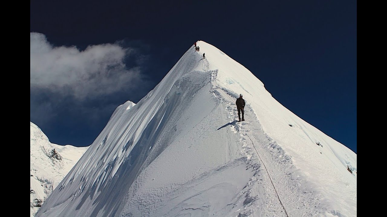
The trail leaves Charang to the northwest and once clear of the village drops steeply into Charang Chu canyon. After crossing the river the route is initially very steep up a stony track. As you round the corner and head north, a fine view unfolds to the south, with Charang on the edge of the cliff in the foreground and the great white caped Himalayan giants of Nilgiri, Tilicho and Annapurna I behind. Brikuti peak is visible to the South-East. The trail climbs gently along the west side valley to a chorten at 3620 m, about 2 hours from Charang. A further hour takes you to 3700 m with some spectacular caves high up in the cliffs to the east. The path crosses a stream and heads north. The trail now heads across an open region, always climbing gently beside a cliff. Having climbed around 3850 m, a pass is reached and through a narrow window at the summit the view ahead opens out to display the western valley of Lo Manthang.
Just down from the pass is the first dramatic view of the walled city of Lo Manthang and the ancient ruined forts on the hills behind. There is a tremendous view to the east of the red, blue-grey, white and yellow eroded Mustang Khola canyon, to the north lies the flattish red coloured hills and the Tibetan border and the western view is dominated by the snow-capped peak of Manaslu. The descent to Lo Manthang is short and after crossing the small river and climbing briefly the fabled city is finally reached. Meals included: B, L, D
A full day exploration and excursion in the walled city of Lo Manthang. Half day horse back excursion to the caves and monasteries. And after lunch you walk around to explore more of it including visiting the palace of the raja (king). Meals included: B, L, D
The trail descends to a stream and makes a short climb to the large village of whitewashed houses surrounded by hectares and hectares of fields of Ghami at 3510 m. Meals included: B, L, D
Today retrace the upward trail and descend through Chele to the Kali Gandaki and trek downstream of Samar. Meals included: B, L, D
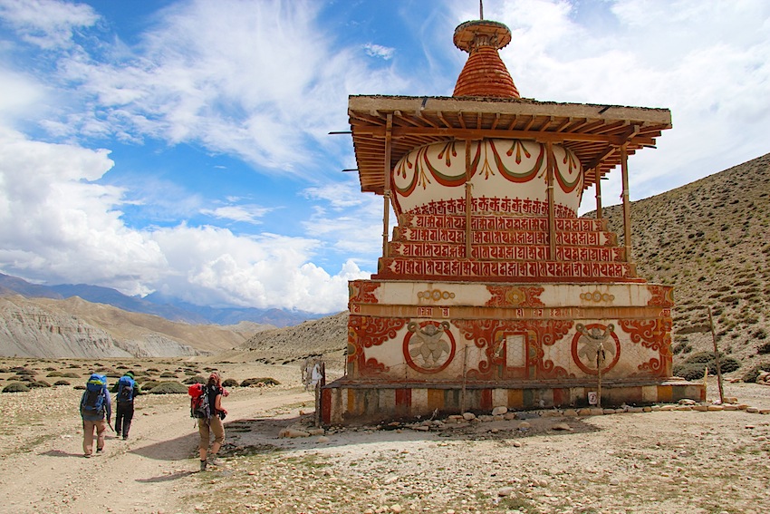
Trek back to Kagbeni before your permit expires. The town itself is unique, also known as gateway to “Forbidden Land” where we stop for lunch. The mud packed houses, prayer wheels, narrow, stone streets, covered alleyway, chortens and old brick-hued gompa dominating the village and guarding the river intersections are reminiscent of old Mustang. Meals included: B, L, D
We retrace our steps through a barren, almost moon-like landscape dotted with patches of green cultivation. Man-made canals cut across the terrain, irrigating the crops and fruit trees. We lunch at Eklebhatti. Heading south, the wide, windswept valley floor has little fertile land, which means a hard existence for the inhabitants of the Upper Kali Gandaki. After a few hours following the valley downstream we arrive back at Jomsom, a dusty and wind-swept town where we spend the night in a lodge to await our flight back to Pokhara the following morning. Meals included: B, L, D
In the early morning we take a spectacular flight back to Pokhara and should arrive sometime in the mid-morning. Our hotel is located close to the lakeside. After a welcome shower, we have the rest of the day free to relax or do some exploring.
*Please note that Jomsom being high up in the mountains, sometimes flights can be cancelled and hence we might have to spend an extra night at Jomsom and hence the extra night at Pokhara will be adjusted. Meals included: B
A free day in Pokhara to explore, shop or just take it easy. Your trek leader will be there to assist you for further sightseeing’s in Pokhara. Meals included: B
After breakfast we drive back to Kathmandu and transferred back to our starting hotel. The rest of the day is free to do shopping or further sightseeing.Our final night in Kathmandu gives us a chance to go out on the town and enjoy a final dinner (optional) with our travelling companions and new-found friends. Meals included: B
Your trip will come to an end today after breakfast. Your leader will be on hand to advise and assist with your onward travel arrangements.Meals included: B
| Trip Start | Trip End | Group Size | Availability | Price |
|---|---|---|---|---|
| 05/05/2024 | 22/05/2024 | 2 - 14 people | Guaranteed | Enquiry |
SUGGESTED CLOTHING AND EQUIPMENT LIST
Head:
Lower Body:
Feet:
Upper Body:
Hands:
Accessories:
Toiletries:
Personal Hygiene:
Extras/Luxuries:
Swimming costume (for Kathmandu & Pokhara)
Please note:
The gears with an asterisk (*) sign are handed out by Himalayan Hikers as a part of service
You can use your personal gears if you prefer to do so i.e. sleeping bag, liner, down jacket