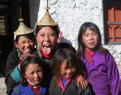
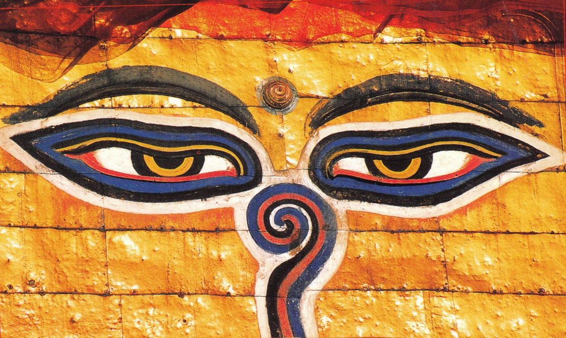
Bhutan lying in the heart of the vast Himalaya and is surrounded by rugged mountain ranges.Towering to the northwest, the stark and dramatic mountains of the Jhomolhari Range form the frontier with Tibet.Very few visitors have entered this tiny Himalayan kingdom and even fewer have been privileged to trek into her high mountains. Jhomolhari (7314m), the sacred mountain of Bhutan, is breathtakingly beautifulBhutan is not just about scenery and unbelievable mountains; it is also about friendly people and an enduring and living Buddhist faith with magnificent monasteries, rich religious traditions, and a turbulent past.The great fortresses or ‘dzongs’ found throughout the country are mute testimony to the wars, sieges and attempted invasions in times gone by.
Bhutan is now a peaceful kingdom where the king is revered and the economy is measured in Gross National Happiness.Trekking through forests, walking above the tree line with nomadic yak herders, enjoying sightings of rare animals, and standing under the dramatic peaks of Jhomolhari make this one of the most rewarding treks in the Himalaya
Minimum 4 pax to run this trip
Upon arrival in Kathmandu, you will be met by our Himalayan Hikers representative and transfer you to the hotel. The drive from the airport to the hotel is around 20 minutes.After your checkin the group leader will set a time for your trek briefing to discuss in regards to the trek. The evening is free but your trek leader will organise a welcome dinner at a fine local restaurant.
Today, you will visit BodhnathStupa, one of the biggest Buddhist shrines in the world and Pashupatinath ,the main temple for the hindus. Here you will see Hindu holy men (sadhus) meditating, pilgrims bathing, and occasionally funeral pyres burning on the ghats. The rest of your afternoon is free. In the late afternoon you will be briefed with your tour briefing. Deparature information for the next morning will also be given. Meals included: B
Today you will be transferred to the airport for your flight to Paro. On arrival in Paro you will be met at the airport and transferred to the hotel.Paro is located in a beautiful wooded valley with terraced farmland along the Paro Chu River. If time permits a short tour will be organised so you can have a look around town.You will then head out to explore the valley by vehicle and on foot before returning to the hotel for dinner (included). There will be a briefing given by the tour leader, and any last-minute arrangements will be coordinated. Meals included: B
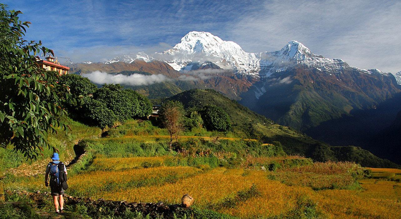
As a warm-up for your trek, you will leave in the morning for an excursion to the legendary Taktsang (Tiger’s Nest) – a small monastery, clinging precariously to a rock cliff 900 metres above the valley floor. Paro Valley is wide and fertile, and one of the most beautiful valleys in Bhutan. Rice, millet, wheat, and potatoes are the main crops produced in the area. You will drive along this valley next to the ParoChhu (Paro River) to get to the trekking trail that leaup to the monastery.The trek climbs steadily uphill and will take about 2-3 hours. After an hour of walking you will stop at a teahouse that offers refreshments as well as a wonderful panoramic view of the monastery.For those interested, it is possible to get a closer view by hiking another 45 minutes to an hour to reach the small chorten directly across from the monastery. Anyone not interested in hiking further can relax at the teahouse and enjoy the view. The monastery was seriously damaged by a fire in 1998, but has since been rebuilt. Legend has it that the Great Guru Rinpoche (Padmasambhawa) flew here from Tibet on the back of a tigress to subdue the demons of Paro Valley. Time permitting, you may also make an optional visit to Ta Dzong, a circular fortress built in the mid 17th century and now converted into the National Museum that houses an excellent collection of Bhutanese antiquitiesYou will return to Paro for an overnight stay. On clear days you can see the peak of Mount Chomolhari (7314m) – Bhutan’s second highest peak. Meals included: B, L, D
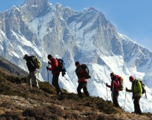
After breakfast you will drive on a winding road up the ParoChhu to DrukgyelDzong. The dzong was built in the 17th century and played a strategic role in repelling many a Tibetan invasion. The fortress is now a burnt shell.Your trek starts from here and in fine weather the towering peaks of Chomolhari will appear as a backdrop. Today you will walk at a relaxed pace through green, flooded paddy fields and small villages, following the Pa Chhu.Initially your walk is through forests of fir and pine, before opening out to open pastures. There is a large army post at the village of Gunyitsawa, from where you will have a further 30 minute walk to the overnight camp at Shana.The camp is set amongst the fir trees with the ParoChhu running swiftly by. During the entire trek, horses will carry all your food and equipment. Meals included: B, L, D
Today is a long day with plenty of ups and downs and a considerable amount of time spent avoiding mud holes.From the camp you will walk through picturesque countryside, crossing and recrossing the ParoChhu many times. You will leave the last of the paddy fields and slowly gain altitude through forest, with the chance of seeing wildlife such as langur monkeys, deer, wild boars, and even bears. The bears are usually harmless unless suddenly disturbed – this can frighten them and lead to a more dangerous situation. By travelling in groups and taking care when going around bends, we can avoid these situations. The Bhutanese shout or sing to warn off the bears!You will camp at Soi Thangthanka. Jhomolhari can be seen at the top of the valley if the conditions are clear. Meals included: B, L, D
Today your walk will involve an ascent through a beautiful valley with pleasant views of the river below. After an hour or so, the thick forest opens into areas of wind-blown scrub trees and then yak pastures. You will stop for lunch at Nengethang, a village of yak herders, you won’t see many herders here at this time of the year, as they are usually at higher altitudes. The elderly, the women, and children are more often the ones in the village at this time.The afternoon’s trekking takes you near to the village of Jangothang and, as you gain altitude you may witness spectacular views of Jhomolhari and Jichu Drake (6794m). Meals included: B, L, D
At this point you will have reached the Jhomolhari Base Camp area in high alpine country. You will probably notice the affects of the increase in altitude and even small hills can present a challenge, but the views are ample compensation.Jhomolhari is considered to be the sacred abode of the female god, Chomo. (Chomo – name of god, Lha – god, Ri – mountain.) The peak was first climbed in 1970 by an Indo-Bhutanese expedition, they left a sanctified image of the Lord Buddha on the summit. Here yaks graze against the backdrop of huge icefalls; the scene is one of incredible Himalayan grandeur. Chomolhari was seen by Irving and Mallory on their 1921 expedition to climb Everest. George Mallory described it as ‘astounding and magnificent’. Meals included: B, L, D
The decision to rest or not is yours. If you are feeling the effects of altitude, then a total rest day is recommended. If you feel good however, the best thing to do is walk higher, then return again to sleep at the lower altitude. There are optional day walks in three separate directions. One takes you to a high point on a ridge with views across to Jichu Drake and Jhomolhari, another can be combined with a ridge walk plus views across the valley, and the third goes to the head of the valley in the direction of Jhomolhari. Meals included: B, L, D
Today’s walk is very short, so it is possible to enjoy another day hike from Jangothang before heading to the lakes and your new campsite. HRH Prince NamgyalWangchuck stocked the two lakes with brown trout in the 1960s, so those interested in fishing may wish to head up to the lake earlier in the day and try their luck.The trail crosses the river before climbing up to the lakes. This is a steep 45-minute climb with spectacular views of Jitchu Drake and Jhomolhari, which grow more and more impressive as you gain altitude. Once you reach the top of the plateau, the trail levels out and after crossing a small hill, the first lake comes into view. This is a spectacular walk with the three major peaks rising above the valley, a broad stream on your right and snow-covered peaks in the distance. Meals included: B, L, D
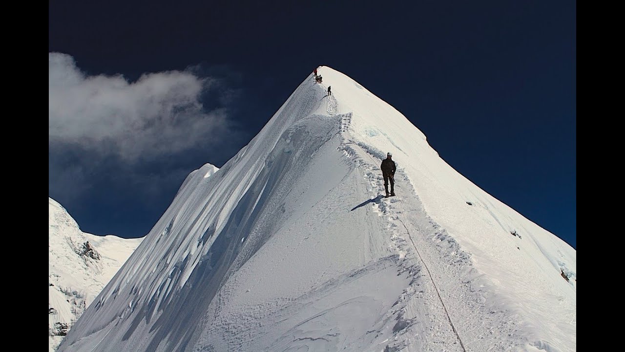
Today you will tackle Bang Tue La (Pass), which at 4700 metres, is the highest point on the trek. An early start is recommended to allow enough time to reach camp. This also means you can conquer the pass in the morning when the weather is at its most stable.The trail leaves the valley floor and begins the climb to the pass with a steep traverse of a scree slope. As you near the top of this first incline, you will cross a small glacial stream. The trail winds up to an upper valley with snow-capped peaks in the distance.
You will skirt around several streams and a small lake as you make your way towards the final climb to the pass. Be on the lookout for blue sheep on the steep hillsides above the valley, as well as marmots emerging from their burrows on the ground.From the pass, the trail drops quickly to a huge grass-covered plateau dotted with yak herder tent stone circles. The valley of SoiYaksa is incredibly scenic and ends abruptly at the foot of a steep cliff. Above the valley floor, the landscape comprises of cliffs, waterfalls and, higher still, snow-covered peaks.
Above the cliff to your right, the mountain rises to a dramatic point, resembling the throne of a local deity. As you ramble through the steep grazing fields you can see the edge of the plateau. You will end your day with a final descent to the valley floor and the campsite situated beside a rushing stream. Meals included: B, L, D
You will climb steadily for 180 metres above the camp before the trail levels out and winds around a ridge and across a stream. There will be another steep climb to a small pass marked by several small chortens.You will stop for a brief tea break and then continue, now above tree line, past one yak herder tent and herds of grazing yaks, before reaching the next valley, characterised a beautiful snow-fed river.
After crossing the river you will begin the climb to the pass. It is steep but there is no time pressure and after one-and-a-half hours, you will reach the second pass – Takalung La (Pass) (4330m). From the pass, you can see the large Thangbue Valley and the campsite for the night. A gently winding trail will lead you downhill to your camp.
If the weather cooperates the view from the pass is breathtaking, with Chomolhari and Jitchu Drake rising over the mountain ranges. You will have a clear view of the Bang Tue La (Pass) (the pass you crossed previously) and the SoiYaksa Valley. Thangbue is a wide valley filled with yak herder encampments, many yaks, horses and a few goats. Meals included: B, L, D
Today’s trail climbs steeply from the camp up the side of a mountain covered with dwarf rhododendron. It is a relatively short but steep climb to the small pass. From this point, you will embark upon a wonderful part of the trek route.For almost two hours, you will walk along a ridgeline trail with drop-offs to the valley floors below on both sides. Eventually you will drop down from the high ridge and you will begin to glimpse views of another dramatic peak – Drake Gang. Like Jitchu Drake, Drake Gang is the residence of a local male deity, while Chomolhari is the home of Jomo, a female deity. You will drop further to a lovely spot with views of the valleys below.
From this tranquil spot, you will begin one of the most challenging parts of the trek. For the next three hours, you will drop steeply on a switchback trail losing about 1350 metres. The trail is littered with many stones, which make footing challenging. Taking it slowly (and watching your knees!), you will descend to the valley floor.As you lose elevation, the landscape changes from alpine with dwarf rhododendrons to lush pine forests with huge old growth trees. As you get lower, you will enter a mixed forest of pine.You will return to Shana for your final night of camping. Meals included: B, L, D
For the remaining journey from Shana to DrukgyelDzong, you will enjoy the relatively flat (compared to the walk from Thangbue!) walk to the road head.After lunch, you will drive to Thimphu, the capital of present-day Bhutan. Thimphu’s inhabitants live on both sides of a pleasant valley with the ThimphuChhu flowing through the middle. By law, the facades of buildings in Thimphu can only be constructed in Bhutanese style.
In the afternoon, you will visit some of the workshops where young men receive a formal education in the art of traditional painting, sculpture and woodcarving. Thimphu has an excellent range of handicrafts, most notably woven cloth, wooden masks, thangkas, silverware, jewellery, and bamboo craft that comes from all over Bhutan. A nearby building houses the National Library. Ancient archives are carefully stored in this repository of religious and historical texts. Meals included: B, L, D
After breakfast you will venture out to explore Thimphu. You will drive to a viewpoint and enjoy an excellent panoramic view of the city. On your way back, you’ll embark on a short ten-minute hike around the small enclosure in the pine trees, in an attempt to spot some takins – the national animal of Bhutan.
Your next stop is the Zilukha Nunnery in DrubthobGoemba, which is home to between 40-65 nuns, and also provides shelter for aging women and orphaned girls. The temple here is dedicated to the famous saint, DrubthobThangthongGyalpo, the man who first introduced and built the chain of iron bridges in Bhutan.You will then pass TashichoDzong (Fortress of the Glorious Religion), the administrative and religious centre of Bhutan located on the right bank of ThimphuChhu. ZhabdrungNgawangNamgyal (Bhutan’s supreme leader in the first half of the 17th century) built the present dzong in 1641, but the original building dates back to 1216. To this day the dzong serves as the seat of the government and is home to about 300 monks during summer. The monks move towards Punakha for three months during winters. You will not be allowed to visit the dzong while the monks are in residence in Thimphu, however you can capture snapshots of the building by walking around it.
You will then enjoy some free time in town to do your own exploration.Other sights in the capital include the National Textile Museum and the Folk Heritage Museum. The ChangangkhaLhakhang is a temple that sits majestically on a ridge above the city.
Next there is some time allocated to visiting the Weekend Market, where all manner of goods are for sale. Everything from handicrafts to dried yak meat is available to the hundreds of people who shop here weekly. In the evening you will return to the hotel for dinner. Meals included: B, L, D
After breakfast you will be transferred to Paro Airport for your onward flight.
*(Please note that your departure flight is not included as part of the trip and must be booked separately).
SUGGESTED CLOTHING AND EQUIPMENT LIST
Head:
Lower Body:
Feet:
Upper Body:
Hands:
Accessories:
Toiletries:
Personal Hygiene:
Extras/Luxuries:
Swimming costume (for Kathmandu & Pokhara)
Please note:
The gears with an asterisk (*) sign are handed out by Himalayan Hikers as a part of service
You can use your personal gears if you prefer to do so i.e. sleeping bag, liner, down jacket