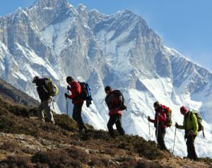
Exceptional high altitude adventure routes to the Himalayan trekking peaks of Mera and Island peak with challenging Amphu Laptse pass
Mera Peak and Island Peak are two famous trekking peaks in the Himalayas. Climbing of the MERA and ISLAND peak with crossing over the spectacular and challenging Amphu laptsa pass makes this Mera and Island peak via Amphu Laptsa pass trip a very special demanding trekking and climbing experience in Nepal . Himalayan Hikers Expedition has professionally designed this expedition Itinerary to allow every participants to have proper acclimatization to summit the two trekking peaks over 6000 meters with less attempted challenging pass and to trek through the three remote valleys of Hinku, Honku and Imja tse in Everest region.
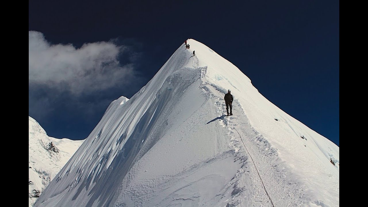
Standing over 6467 meters Mera peak offer the great Himalayan summit thrill , no doubt a high altitude long introductory climb to the summit ,never steep enough to get to scary. Island peak 6189 meters though less on its height,is a little bit more technically demanding and exposed , allowing you to test the climbing skills you have learnt on Mera peak ascent and Amphu laptsa travers crossing . Amphu Laptsa pass is technical to cross where our climbing guides supports the team on fixed rope to abseil on the rocky crest to decent the entire expedition team member, support crew gears and foodstuffs. Our support team also does fixed the ropes and compact blue glacier ice from our south Amphu Laptsa base came to the Amphu Laptsa pass top.
Our office representative will meet you at the airport and transfer to hotel Holy Himalayan where pre trek briefing and other information will given by your Group Leader. The hotel is centrally located near to Thamel (a tourist downtown) Arrangements are made today for the distribution of your HHE kitbag, down jacket, sleeping bag etc. Reminder of the afternoon is free. For your kind information, your group leader will be happy to assist you in any way he can and will meet you every day while you are in Kathmandu to help you with any queries. The evening will be highlight by traditional Nepali cuisine as a perfect end of your very arrival day in the Himalayan Kingdom of Nepal.
Today you have time to explore Kathmandu valley, which has more World Heritages sites than any other cities in the world. The capital city has an imaging range of traditional fascinating highlights, whatever your interest. After the guided tour, afternoon is free to pack, purchase last minutes items for your trek or simply relax.
Early on the morning, we head towards the STOL airport for 45 minutes thrilling mountain flight to the airstrip at Lukla which was built by Sie Edmund Hillary and his friends, when he started his social work of building schools and hospitals for the local Sherpa people .At Lukla, the first glimpse of all huge mountains are quite impressive which surround the very village,but be patient, it is just starting, there are lots more to come on your way . Our expedition route to Mera to the south is a welcome escape from the crowded trail to traditional Everest base camp. Keeping the need of acclimatization before summit in mind we follow off the beaten trail rather going from the direct ascend to Zatrawa la (4600m) immediately after Lukla . After having lunch at Surkhe you will pass through many traditional villages to reach to the vicinity of Phuiyan for our first night camp.
Tody, we will see “Mani Wall” which is a compilation of many stone tablets , each with the Buddhist chanting inscriptions, “Om Mani Padme Hum ” which means , “Hail to the jewel on the lotus”. Please respect the local tradition as the local people walk left to these Mani Walls.
After a short walk from Phuiyan our trail breaks away, leaving the main routes to Namche Bazzar and head east into the mountains, following the old trading route linking the Everest region to the Arun valley. We rise to spur pass,Khari La (2990m).The viow north and west fantastic all the way to Cho Oyu . Our expedition Kitchen staffs prepare the fresh hygienic lunch on the way to Kharikhola valley. A narrow trail high above the Kharikhola valley climbs steadily through terraced fields and gorgeous forests with many waterfalls, to the handsome village of Pangkorma(2846m), where we camp and enjoy the impressive views of Numbur (6950m), Khatang Ri (6853m), Koryolung (6681m), Kwangde (6187m)
In the cool of the morning we head up towards the Pangkongma la pass (3140m) behind the village, marked by some very ancient looking Chortens. Once we entered the Hindu valley, immediately there is a feel of unspoilt remoteness. Across the valley are thick forests broken only by a few Kharka pasture settlements. Snow peaks top the ridge opposite but it is not until we round the corner that Mera comes into view guarding the head of the valley. From this angle it looks very impressive, and anything but easy! We descend through some scattered settlements and hyave lunch at one of the lower once. The Hinku River, seen crashing through inaccessible gorges down from the north, is tucked away here, far below, reappearing as it winds its way south into incredible hazy distance. We can see our night stop opposite, seeming so close and can follow our route of the next few days running along the ridge above. The afternoon takes us down an excellent steep path to cross the river. The most dramatic waterfall so far plunges down the opposite bank. The climb up is less steep and takes us into some deep forests before emerging to camp in the pastures of Narjing Dingma, settlements of bamboo hunts.
The forests continue as we ascend, now mainly rhododendron. From the Surkie La (3085m) we head north along the ridge, and the whole of eastern Nepal opens out in front of us, over the wildly remote Honku valley, with the solitary bulk of the Kangchenjunga massive marking the Sikkim boarder. As we head up this ridge today and tomorrow, we will pass from side ti side with immense dramatic views either way. This first section which is also called ‘Raspberry Danda’ with all these delicious wild berries is ripe to perfection in October. We have lunch and later camp (3450m) in the grassy pastures, called Chalen Kharkas.
From here up the ridge is cragged with lichen rocks and heathers, and we wind our way up over several rises. The ridge narrows as dramatic gullies drop away steeply on either side. Over a final crest (4330M) we reach the unexpected suspended ledge of the lakes of Panch Pokhari five lakes, the sacred number.this is a place of pilgrimage for both Buddhists, who line the edges of the lakes with Chortens,and Hindus,who leave aforest of tridents, the symbol of Shiva the mountain born god of destruction and re birth.this is a very potent, evocative side.A short descent beyond the sacred place brings us into the Khula Kharka(4120m),our night camp
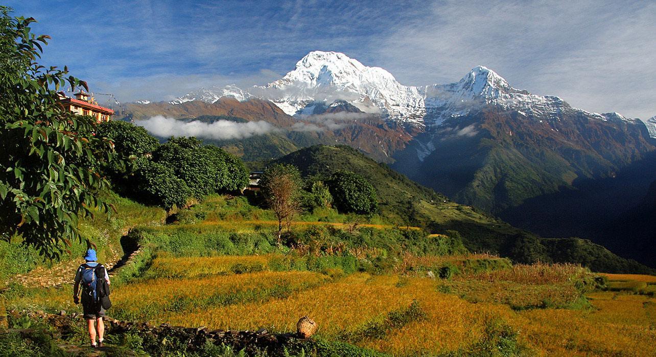
An excellent trekking day,walk through the dwarf juniper,rhododendron and lovely mixed firs will add the beauty in your trip.Enjoy the great view of Mera and Hindu valley before we descend steeply to the phenomenal cascading junction of two mountain torrents, crashing down through tall pine forest all around our lunch side .these totally unspoilt forest become even more majestic, as we soon rejoin the main river, crossing it to continue up the west bank and reach Khote(3480m) where we will camp. The flood of 1998 particularly devastated this side when the Sabai Tcho glacial lake broke its moraine dam. The tea huts have now been rebuilt but the previously grassy campsite is now a beach!the final crest of the Mera ridge including the summit is clearly visible up at the end of the valley ahead.
The forest gives way to open valley again by mid- morning, revealing the peaks which line either side. A small Buddhist Gompa in the rock wall above the path contains some unexpectedly fine Buddha statues within. The valley swings eastward into a new array of peaks and the route up toward the Mera glacier comes into the view. We have reached the surprisingly well-established summer settlement of Tangnang (4140m) where our expedition Sherpas as set up camp. Towering over our heads the sheer flank of the Mera ridge dramatically dominates the skyline. Be patience! Our climbing route on Mera approaches from the north side not up the sheer rock walls of the impressive southern side.
This acclimatization day is very important and useful for boosting yours adaptation to the altitude by gaining as much height as we can during the day but returning to Tangnang for the night. Opposite the Mera ridge the Tangnang valley leads up to a long range of peaks connecting Kusum Khanguru north to Kang Teiga. Depending on how you are feeling you may take an opportunity of morning acclimatization climb to the glacier level (about 5000m), mostly a rocky scramble, with great views of Mera behind or head up the slopes to the north to look at what is left of the glacier lake, Sabai Tcho. You can still see a distinct line, far above, marking where the water had once reached.
This morning’s walk up alongside the dig glacier is easy and relaxed. This is an axcellant valley opening out views to the north of the Hinku Nup glacier and the the line of peaks beyond. Behind us is the dramatic spire of the less than romantically named ‘peak 35’ which has yet to be climbed. Only the last section up to our base camp at Khare (4940m) is steep and reminds us that we are gaining altitude. It’s a short climb and we are there in good time for lunch. This will be our bese for the next 3 nights, thoroughly developing our acclimatization, with successtively higher day ascents, descending to sleep low and consolidate our energies for the final ascent to come. We start this process this afternoon, with a gradual ascent of an excellent grassy ridge immediately behind the camp (to 5260m) which also gives us great all round views of the flattened ridge across the glacier which we will ascend tomorrow, and south to Mera itself, including the pass, the high camp rock outcrop and 3 summits arrayed along the ridge.
Today we gain more valuable acclimatization and pick up some stunning views as well. Following the lateral moraine of the Hinku Nup glacier into an arena of peaks and glacial lakes, we turn to ascend grassy ridge that rises back to south. At top we are surrounded by stunning panorama of peaks including the real summit of Mera itself and the whole of Hinku Himal to the north right round to the south face of Ama Dablam. In the afternoon your climbing Sherpas will instruct you on the practice of roping up in a glacier walking.
Ascending the steep edge of the glacier is an idea to practice crampon use and ice axe technique, and to get the feel of jumaring on a fixed rope. On the top we find a suitable area with a safe run-out to learn self-arrest, the single most important skill of alpine mountaineering, even if little needed on the safe slopes of Mera. If the conditions are right we should all have mastered the principles by the end of the session. On the descent we’ll do some easy angled abseil, and other fast descent methods. We return to Khare for a comfortable night with enough acclimatization for our ascent to high camp.
We return to the glacier, and this time follow it round in a wide arc, keeping close under the northern flank where there are no crevasses. The last section is almost level and Mera La (5410m) itself is a rounded snow cool that bridges south to the main sweep of the Mera glacier coming down from the peak itself. The Honku valley, which is op[en out in front of us dominated by the massive southwest face of Chamlang. Impressive Mt.Makalu fills the gap to the north. After the last 3 days acclimatization we are ready for continuing to establish our high camp and prepare for the summit bit. The slopes are easy angled, and the snow is usually in firm condition, but as the altitude increase it can still be breathness work. There is plenty of time to work in the continually unfolding view. The site we are making for is on a rock outcrop (5800m) that separates the Mera from the Naulekh glacier sweeping down from the peaks alone the continuous ridge to the south. This has got to be one of the most amazing camp view points in all the Himalayas. Kanchanjanga just above the ridge of Chamlang dominates the eastern side. Mt.Baruntse appears to the left of Mt.Makalu. We can see the whole of the great sweeping ridge line from Nuptse up to the forbidding mass of Lotse’s south face running through to Lotse Shar. And over the ridge stands the summit of Everest, the final stages of traditional route up the southeast ridge and ovr the south summit to the summit ridge, visible only from this angle (or from the summit of Ama Dablam). Just to the right of Kang Teiga, which dominates the western foreground, we can see all the way up the Ngozumba glacier widening from Gokyo Ri to Cho Oyu, bringing our tally of 8000m peaks to an unbelievable five. We are likely to get an amazing sunset as a reward being on the historical Mera expedition.
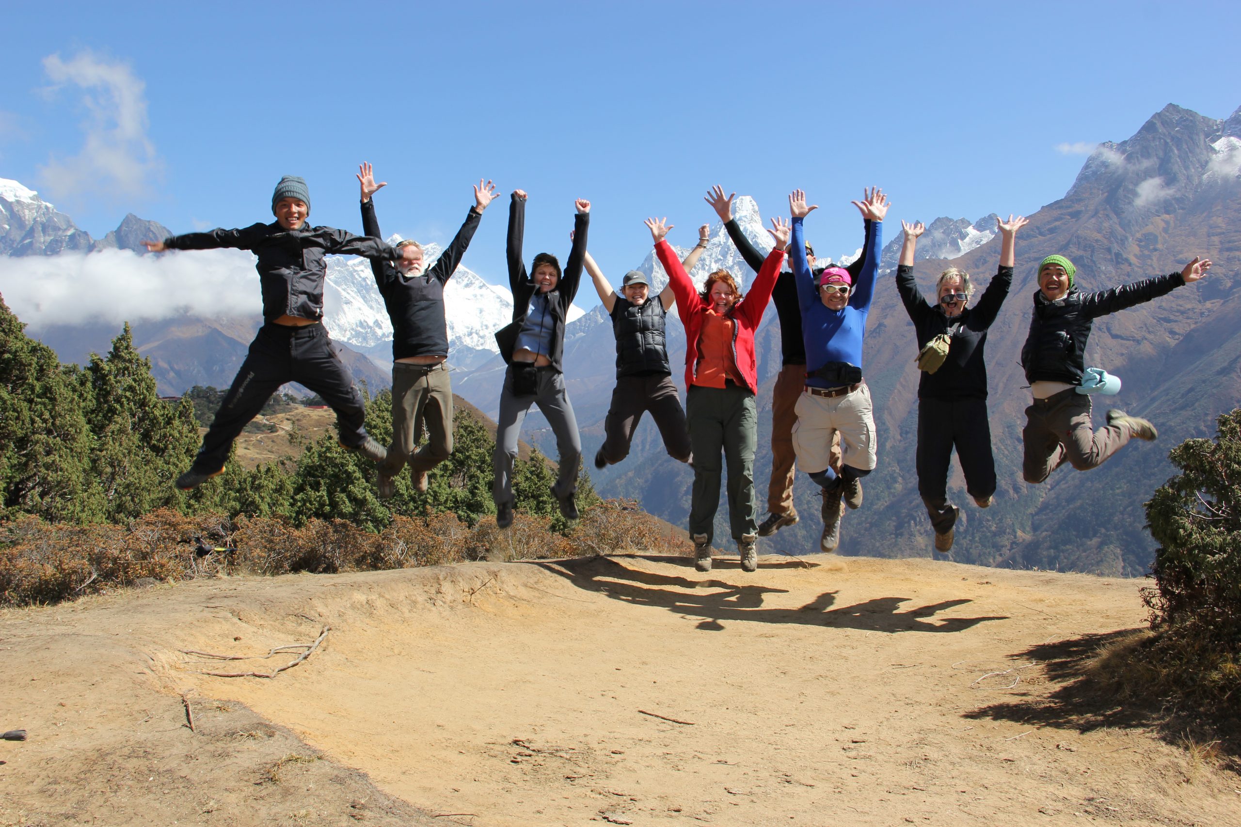
This is the most important and toughest day in any mountaineering trip as you will be awakened before the dawn with the high esteem to summit the peak. After the steaming hot tea and a quick beaky we continue all roped up through the main glacier then crossing back to the south side we approach the snow humpback ridge. The first shafts of the sun hit the big peaks behind us and are soon on our own slopes, an amazing horizontal red glow. The route is still non- technical;30* slopes, one foot in front of the other, count the steps and take a breather. The slope becomes steep for a section behind the ridge and then we swing diagonally westward. The summit comes back into view and we are on the level summit ridge. At the foot of the final steepness we can attach to our fixed rope on the route that safeguard this 30 meters 55*pinch. You can jumer or not. The snow conditions are normally excellent at this early hour and pulling out on top, such speechless backslapping and then you start to take in the panorama. The best viewpoints of the Himalayas are the change combination of accessible height and location. Mera has this to such perfection. It stands at the center of the highest section of the entire range, a little bit back so the minor peaks do not obscure the major once -360* of the range greatest peaks on earth! The exhilaration of reaching the summit; this incredible location; is really impossible to describe in words to any one before they have done it. Take your time to let it all in, the achievement, the experience being on the top of majestic Mera. After that we head right down to Mera La for the camp tonight.
In the morning we descend down to Ongmadingma having super views of Honku valley and surrounding snow capped mountains. This lovely valley is a high and wild, rarely trekked by other trekker unless climbing group. We follow always guider or members of staff due to less trodden valley the trail is almost marginal so if there is fresh snow you can easily lost the way. Today’s walk would be easier and short distance you are setting lunch and camp at same place to subsidize your day’s tiredness.
Morning you continue towards the upper valley following the glaciated Honku river and high Yak pastures in the incrediblewilderness. On the half way of the trail we stop for lunch with great views of majestic maintains. Afternoon walk will gain some elevation to reach the campsite and tents are fixed on the edge of the lake.
We started walking steadily towards Amphulapcha Base Camp experiencing serenity of remote valley with some nervousness that we are going to do among challenging high pass in the Himalaya’s in following day. At first we weave alone a good path between the glacier and the valley, the valley then opens up to reveal the amazing pinnacle of the west cool. You follow the ‘Magic moraines’ in between camp, with looming Baruntse in front of you. Finally, the trail climbs onto the flat land in Conner where we spend the night.
We started early morning to the pass climbing steep sections of Rocks and Ice we set off across the glacier roped up through there are few crevasses and overhangs, the pass is challenging both sides until you reach at bottom other sides of the pass. Most of the route up the ridge is about 20* to 30*and we will move together as roped teams. The views from the pass summit towards the north face of Everest are superb. We roped up in the steep sections while descending and take for lunch break to recover muscle-ach and afternoon we walk towards down valley and camp at on the edge of glacier.
Following the Imja Khola valley we ascent gradual, crossing small streams, through open alpine pastures with fine views of Island Peak at the head of valley. We reach Island Base Camp being surrounding by icy peaks. The views of the massive Baruntse Wall and Ama Dablam are particularly impressive. After the lunch we explore the side of the lateral moraines of the Imja glacier and surrounding the beautiful Island peak base camp. Himalayan Hikers staffs have set up the two men climbing dome tent for you and our cook prepare the delicious food for you.
This rest day will help us to have a successful summit of the Island peak. Today our experience mountaineering expertise – climbing Sherpa will give you the climbing information of the peak. The aim of our climbing clinics is to build self-confidence and increase the rate of success to each participant. Climbing Sherpa and trek leader brief the group on the theory and practical use for climbing gears like ice axe, zummer, crampons, rope..
This is one of the tough and important as it is a summit day. We leave the Base Camp early at round 3 am usinghead torches. After about half an hour’s walk along the moraine at the side of the glacier we turn up the screes of Island Peak. This trail is clear but it is stiff walking at over 5000m and cold. The scree finished at the site of the High Camp and we begin scrambling up easy angled rock. After some time we join a rib and scramble along it to a point where the glacier weaves joins the top of the rocks. Here we put on crampons, harnesses and rope up. The route weaves through the crevassed glacier eventually reaching a steep headwall leading to the summit ridge. Normally the guides and Sherpas will climb this first and fix a rope down at this section allowing members to zoomer up and on return abseil down. The summit ridge is quite narrow and sometimes corniced. We continue roped up along it to the small shapely summit of Island peak top where the panoramic Himalayas enthrall you making your historical trip of a lifetime.
It seems be a tendency to rush; particularly as we are walking downhill but at same time there are still lots more to see. We descend along the meandering trail to Pangboche and visit its historic oldest monastery in khumbu before continue down to the Imja Khola (river).the bridge across the river is spectacular and the rapids of the water cause the river to roar beneath us.
It seems much quicker and easier going down! There can be tendency to rush as we are walking downhill, but there is still much to Thyangboche on the way to Namche, the Sherpa capital where we will visit the Tyangboche monastery. This monastery was recently rebuild after it was destroyed by fire in 1989 AD. As this area is a devote Buddhist region, the wild life is unharmed so there is possibility that we may see some wild animals such as musk deer, mountain goat, and Pheasants etc.
We retrace our steps along the same Dudh Koshi through pine and rhododendron forest with aview of Kusum Kanguru and other splendid mountains behind us before a gradual climb out of the river valley to the trek starting point Lukla to savior our final mountain sunset of the trek as we complete this exhilarating journey.
This morning, we have a flight from Lukla to Kathmandu; it is a thrilling exciting flight over forests, fields and villages with the Himalayas at the background. On arrival, we transfer to the hotel. The reminder of the day is at leisure.
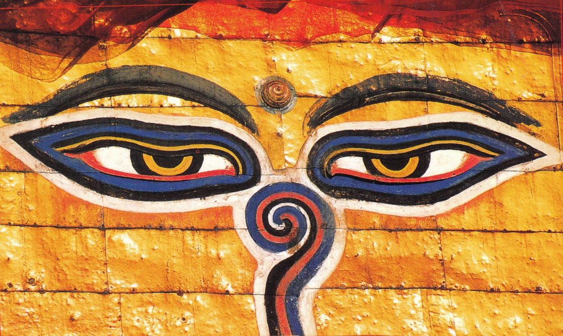
There are lots of interesting things to see in Kathmandu valley: the Royal Palace, Durbar Squares, Swayambunath (the monkey temple), Pasupatinath, Bouddhanath , Patan and an ancient city Bhaktapur etc.or you may explore down town to shop for souvenirs, getting your photos or slides processed and truing out the various restaurants in Thamel.
Your trip comes to an end today after breakfast. Your leader will be on hand to advise and assist with your onward travel arrangements. A departure transfer to the airport is included. Meals included: Breakfast