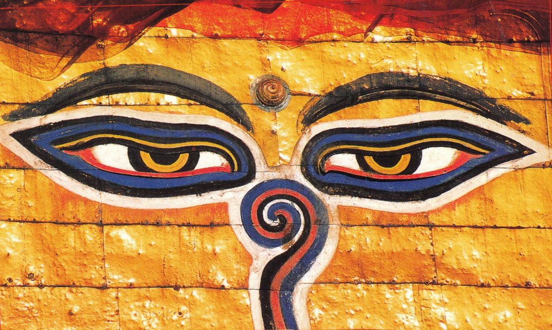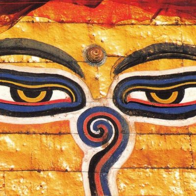
This ride is one of the classic ride that entail riding in the rain shadow part of the wind-swept desert landscape of the Himalayas with views of implausible gorges, high passes and enormous vistas. The ride to Lo-Manthang entails passing through authentic Tibetan villages, barren ridges, deep canyons, eroded cliffs and Moraine valleys. Its landscape is unrivaled for it has a stupendous wilderness, pristine scenery, snow capped peaks, spectacular 16th century monasteries and caves. The founder of Tibetan Buddhism, Padmasambhava, came here centuries ago to defend Buddhism against the forces trying to destroy it. To celebrate his successful battle, he built the temple of Lo Gekhar that still stands today, surviving along with an unadulterated Tibetan culture that cannot be found elsewhere. For political reasons travel into Mustang was strictly forbidden and the region remained isolated from the modern world. In 1992 it was decided to allow outsiders in on a very limited basis. This isolation has helped maintain a way of life almost unchanged for centuries.
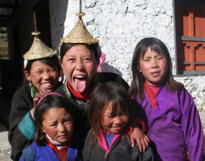
In the early 7th century the land of Upper Mustang mainly Lo Tshu Dhyun was highly influenced by Lasha of Tibet. The land was granted to retainer of the Ghunthang King of western Tibet. In late 1300’s a warrior Ampel (first king of Mustang) from Tibet defeated the local warlord’s to unite the kingdom and established his capital at Lomanthang. The Kingdom of Lo-manthang or Mustang situated at an altitude of 3770 m is an independent kingdom having allegiance with the democratic republic of Nepal. Though the people call themselves Lobas- people from Lo, they are very much Tibetan and practice a sophisticated culture and economy. The King’s palace is an imposing 4 – storey building in the center of the walled city. It is the home of the present king – Jigme Parbal Bista. The Honorary title “Bist – a high caste title in Nepali” was conferred by the King of Nepal. Though his duties are largely ceremonial, he is respected by the people and consulted about many issues by villagers throughout Lo Despite the apparent squalors of Lo Manthang, the city is prosperous and maintains a strong sense of community.
Upon arrival you will be met by the representative and board the waiting vehicle and drive to the hotel. Guest will be welcomed with the welcome drink and the rooms will be assigned. The city stands at an elevation of approximately 1,370 meters (4,500 ft) in the bowl-shaped Kathmandu Valley of central Nepal. It is surrounded by four major mountains: Shivapuri, Phulchoki, Nagarjun, and Chandragiri. Kathmandu Valley is part of three districts (Kathmandu, Lalitpur, and Bhaktapur), has the highest population density in the country, and is home to about a twelfth of Nepal’s population. Historically, the Kathmandu Valley and adjoining areas were known as Nepal Mandala. Rest of the day is free to relax and explore around the hotel. The late afternoon will include a short briefing about the ride and will be carried out at the hotel lobby also the Road captain and the mechanic will be introduced. Later board the waiting vehicle and proceed for awelcome dinner at typical Nepali Restaurant (Bhojan Griha). This is the first Nepali restaurant of its kind in Nepal. After dinner, board the waiting vehicle and drive to Hotel. Overnight Hotel Yak & Yeti or similar.
After breakfast met by the road captain and proceed for the sightseeing tour on a motorbike. Today we will be riding to Nagarkot via ancient Bhaktapur Durbar Square. Firstly the road captain will give a short briefing about the safety that is to be followed during the ride in the roads of Nepal. After the briefing start your bike and ride to Nagarkot. Nagarkot is approximately 32 kilometers. Firstly we will be riding to Bhaktapur for the sightseeing. Bhaktapur is approximately 12 kilometers from Kathmandu.Upon arrival at Bhaktapur park the bike and proceeds for the sightseeing tour of Bhaktapur.
Durbar Square: The main square of the city contains innumerable temples and other architectural showpieces like Lion Gate, the statue of Bhupatindra Malla the Picture Galley, the Golden Gate, The Palace of 55 windows, the Bastille temple and the Bell of barking dogs, etc. The statue of Bhupatindra Malla in the act of worship is placed on a column facing the palace. Of the many statues available in Nepal this is considered to be the most magnificent.The National Art Gallery: Contains ancient and medieval paintings belonging to Hindu and Buddhist school depicting Tantrics of various period and descriptions.The Golden Gate: The Golden Gate is the entrance to the main counter of the Palace of 55 windows. Built by King Ranjit Malla, the gate is one of the most beautiful and richly carved specimens of its kind in the entire world. This gate is embellished with deities and monsters of marvelous intricacy.
The Palace of 55 Windows: The palace of 55 windows was built in the seventeenth century by King Bhupatindra Malla. Among the brick walls with their gracious settings and sculptural design, is a balcony of 55 windows. This balcony is the masterpiece of wood carving. Natyapola Temple: This five storey pagoda was built in 1702 A.D. by King Bhupatindra Malla. It stands on a five-terraced platform. On each of the terraces, squat a pair of figures, two famous wrestlers, two elephants, two lions, two griffins, Baghiani, Singini – the tiger and the lion goddesses. This is one of the tallest pagodas and is famous for its massive structure and subtle workmanship. After the sightseeing tour of Bhaktapur Durbar Square take lunch at nearby restaurant and later ride to Nagarkot. Nagarkot is approximately 20 kilometers from Bhaktapur. Nagarkot is situated in a strategic location; Nagarkot was an ancient fort of the Kathmandu valley to monitor external activities of another kingdom. Later, it became a summer retreat places for the royals before becoming popular as an international hill station. This small hilltop lies on the ridge at an elevation of 2195 meters approximately on the valleys northeast rim overlooking a big chunk of the Western, Central and the Eastern Himalayas, including five of the worlds 10 highest Peaks- Mt. Everest (8848 m), Mt.Lhotse (8516 m) , Mt.Cho-Oyu (8201 m), Mt.Makalu (8463 m), and Mt.Manaslu (8163 m). Beside these sleepy magnificent giants, Nagarkot also offers one of the best sunrise and sunset over the horizon, late afternoon we go for a jaunt to the vantage point to see the sunset, this beautiful sight will be rewarding after a hard day’s work. Evening at leisure or can explore the vicinity. Upon arrival at Nagarkot ride around and later ride back to Kathmandu. We ride back the same road to Kathmandu.Upon arrival at Kathmandu one can fix the bike with the help of the mechanic and rest of the evening is free to relax and explore around the city. Overnight at hotel.
After breakfast, we negotiate the traffic out of the Kathmandu city and reide out of the valley at the cross section of the ring road at Kalanki and then set out for check post at Nagdhunga, just past Thankot. From here, the road twists and turns as we negotiate the traffic and descend to Naubise, 26 kilometer marker (about 17 kilometers from Nagdhunga). Then the road becomes much larger and a much more smoother enjoyable ride on the highway to Kurintar, 103 kilometers from Kathmandu. Another two kilometers brings us to the Manakamana temple. We continue rideto Mugling, the junction where the highway bifurcates, South to Chitwan and West to Pokhara. Head west crossing the bridge and follow the Marshyangdi River for about 25 kilometers which lead us Dumre town. Continue for another ½ kilometer and then take the left turn to the Bandipur Township. This 8 kilometer drive is a pleasant one as we continue to ascend on a winding path. Near the top we divert on a rough track for about 1 ½ kilometers to arrive at a clearing and the Bandipur Resort which is hidden from view lies at the edge of a clearing in a densely wooded area overlooking the valley below. Upon arrival check into the hotel and rest of the afternoon is free to relax and explore around the Bandipur village. Bandipur is a picturesque town nestled in the Himalayan foothills of Nepal, a land as famous for its natural beauty as for the hospitality of its people. Bandipur has been described as a natural view tower as one can view the spectacular panorama of the entire Annapurna Range plus the peaks of Dhaulagiri, Manaslu and Langtang from here. Apart from the stunning views of the Himalaya and the Marsyangdi Valley, a visit to the town is an opportunity to get a close look at Newar cultural life. Overnight at Hotel Gaun Ghar or similar.
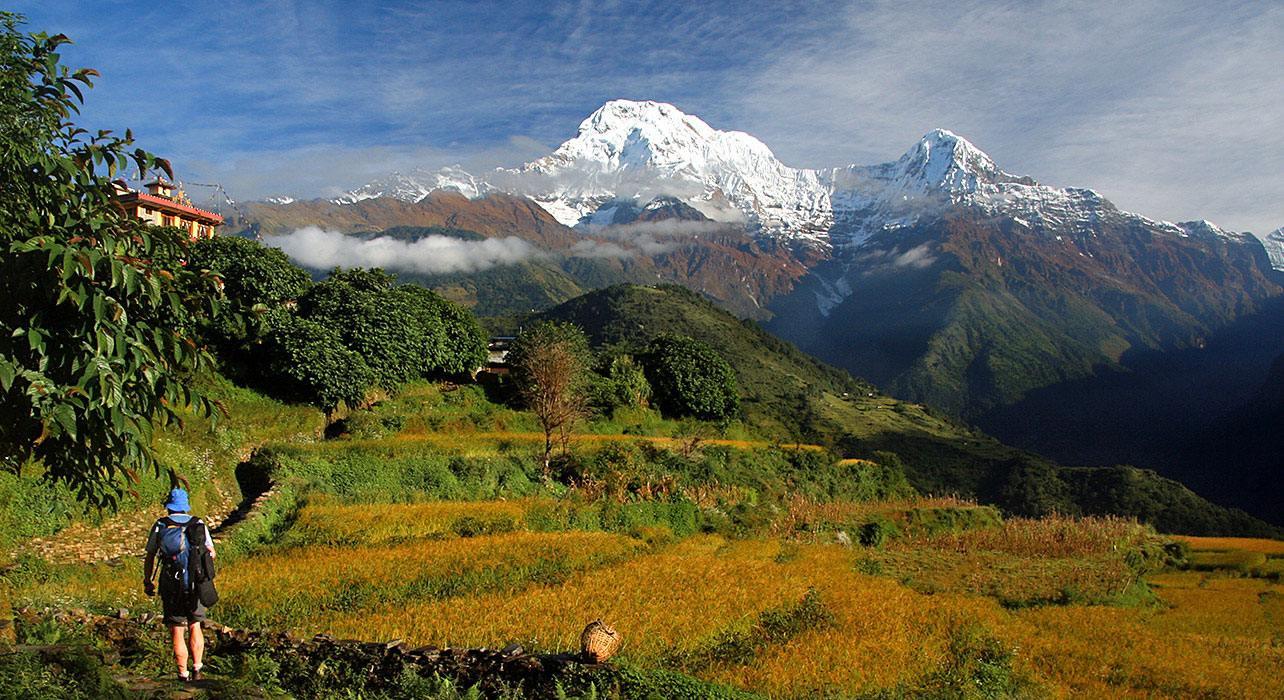
After leisurely breakfast board the waiting vehicle and drive to Pokhara. Pokhara is approximately 85 kilometers from Bandipur. Firstly, descend to the main highway near Dumre and then head west following the Marshyangdi River for a while and then slowly ascend through terraced agricultural lands and small road side villages. At the outskirts of Pokhara, we are greeted with views of the Annapurna Mountain range including the famous Fish Tail Mountain. Pokhara stands at 827 meters above sea level and is an ideal vacationer’s paradise. With its crystal clear lakes, magnificent views of the Annapurna Mountain Range and its bustling but quaint lake side bazaar, it is a major tourist attraction. From here most of the treks starts for the western region and is a haven for people who wants to relax in this serene mountain beauty. The Annapurna mountain range is impressive by any standard and looming ahead to take the center stage is Machapucchre or “Fish Tail Mountain”, which gets its name from the shape of its summit and flanking it from either side are the great mountains of the range including Annapurna I (8091 m), the first 8000 m peak to be scaled in 1950. The range continues to meet the Lamjung Himal in the east while to its west looms the massive dome of Dhaulagiri (8161 m). Upon arrival check into the hotel. Rest of the day is free to relax or explore around the lakeside bazaar. Overnight at the Fishtail Lodge or similar.
After an early breakfast, leave Pokhara and ride towards Beni (approx. 70 Kilometers) on the Baglung Highway. This section of the ride provides fantastic mountain vistas, picturesque terraced farmlands and an opportunity to walk on one of Nepal’s famous suspension bridges. At Mal Dhunga, leave the main highway by taking the right trail and follow a dusty graveled path all the way to Beni, the district headquarters of Myagdi District in Dhaulagiri Zone. It is located on the confluence of Kali Ghandaki and Myagdi rivers at an altitude of 799 meters and is a bustling town lined with stores, restaurants, hotels and various government offices. From here, the road is unpaved and dusty with potholes in several places.Unpaved, graveled rough road poses a real challenge for riders and makes it more difficult with the occasional river crossings. Ascend gradually through the Kali Gandiki gorge, the deepest gorge in the world. There is a continuous change in the topography with every twist and turnuntil our arrival at Tatopani. “Tato” means ‘hot’ and “Pani” means ‘water’, a name earned courtesy of the hot springs and is a popular place for trekker’s to relax and dip their weary bodies in the natural hot springs. Upon arrival at Tatopani check in to the Lodge. Rest of the day is free to relax or explore around the village and take a relaxing dip in the Hot Springs located nearby. Overnight at the Dhaulagiri Lodge, Tatopani.
After an early breakfast, set out on the trail by following the Kali Gandaki River and passing the Thakali and Magar Villages to Dana (4750 ft./ 1446 m.) famous for its beautiful cascading waterfall. Steeply ascend to Ghasa (6600 ft./ 2012m) and continue the ride on a dusty and one of the difficult section of the road towards Jomsom via the Thakali villages of Tukuche and Kalopani. Enroute, there are fantastic views of the Mt. Dhaulagiri (8167 m), Tukuche (6920m), and Nilgiri (7061m). As we pass between the Dhaulagiri and the Annapurna mountain range, a dramatic change in vegetation is witnessed from green forests, to dry arid desert. It takes gradual acclimatizing with the surrounding. The Thakali’s are the dominant tribe of the valley, related to the Gurung and Magars of the southern slopes.
 Continue the ride towards Jomsom through the dusty graveled “off” road passing smaller settlements and apple orchards. There are excellent views of Mt. Nilgiri and the Kali Gandaki River flows on the right hand side of the trail. This day’s journey is tough but rewarded with scenic views of the rugged landscape, beautiful cascading waterfalls, orange and apple orchards, scattered roadside villages, ancient Buddhist monasteries which makes it ‘One Hell of a Ride”. Jomsom (2713 m) is more correctly known as Dzongsam or New Fort. It spreads over both the banks of the Kali Ghandaki. The towering peaks of Dhaulagiri and Nilgiri form an attractive backdrop. Being the district headquarters, it is primarily an administrative and commercial center with government officials and merchants rubbing shoulders with the local inhabitants of the region, known as the Thakalis. Jomsom is the Administrative center of the Mustang region and the gateway to the Annapurna region. A land of mystique, the rugged peaks of the Annapurna, Nilgiri and Dhaulagari gaze down in their awesome splendor at weathered landscapes that contrast with the deep river ravines over noisy riverbeds. Jomsom is a mixture of hard work, social frivolity tempered by culture founded on deep religious traditions. It has the only airport that operates daily scheduled flights to Pokhara in the early mornings before the winds build up. It is a convenient place to stop for lunch.
From here continue ride passing through the village, past the High Altitude Mountain Warfare School of the Royal Nepal Army and through several restaurants, bhattis and a hospital. We cross the bridge and ride through the old Jomsom village which boasts of several lodges, restaurants school and government offices. At the end of the village the valley opens wide, take the left side of the trail just after crossing the three ruined chorten and continue on the east bank of the Kali Ghandaki River. After about 20 minutes, arrive at Ekklaibhatti a small village with few lodges. There are two trail here. The left will lead to Kagbeni while the right one leads to Muktinath. We take the right trail and continue to ascend slowly to the settlement of Jharkot, which has a fort “Kot”. From here, another 15 minutes ride on the desert plateau brings us to Muktinath. Upon arrival at Muktinath check in to the guest house. Late PM: If Time Permits Visit Muktinath Temple. The Muktinath Templeis a sacred place both for Hindus and Buddhists and is located at an altitude of 3,710 meters at the foot of the Thorong La (5416 m Pass), Mustang district, Nepal. The site is close to the village of Ranipauwa, which sometimes mistakenly is called Muktinath as well.The Hindus call this sacred place Mukti Kshetra, which literally means “Place of Salvation”. This temple is considered to be the 105thamong the available 108 Divya Desam. The ancient name of this place, before the Buddhist origin was known as Thiru Saligramam. In Muktinath-Chumig Gyatsa all the elements are represented and for this and reasons unseen, yogis from both religions do their meditation at Muktinat. For Tibetan Buddhists, Muktinath (Chumig Gyatsa) is a place of Dakinis (goddess known as Sky Dancers). It is of great importance for Buddhists as Chumig Gyatsa is one of the 24 Tantric places. For Hindus, beside the natural fire representing Brahman and the holy waters, the central meaning of the Muktinath area is veneration of the god Vishnu in the form of ammonites (shilas) called Salagrama – Shilas.
There are many stories which tell of Vishnu turning into stone and all of them are closely connected to the holy Kali Ghandaki River. According to contemporary geologists, the Salagrama – silas (found at the banks and river bed of the holy river Kali Ghandaki) are fossils of a prehistoric insect. This insect is mentioned in the Bhavisya Purana. Therein, Tulasi, the sacred plant so dear to Vishnu, cursed Vishnu to become a stone during one act of their eternal lila. Vishnu said, “To fulfill your curse, I will become a stone (Salagrama-sila) and will always live on the banks of the Ghandaki River. The millions of Vajrakita worms that live at that place will adorn those stones with the signs of my chakra by carving them with their sharp teeth”. After the sightseeing tour of Muktinath Temple descend down to the Ranipauwa (Main Bazaar of Muktinath). Rest of the day is free to relax or explore around the town.Overnight at the Guest House.
After breakfast met by the rest of the team at the hotel lobby for quick briefing. After a quick briefing about the days ride, board the motorcycles ride backtracking all the way till the outskirts of Kagbeni and then turn northeast and ride to Chhuksang Village, the entry point of the restricted Upper Mustang region. Restricted area permits are checked here at the Police Check post. After completing the permits work we continue our ride to Geling. As we pass Kagbeni village we will be riding on the bank of Kali Gandaki River. Kali Meals (Black) and the water of the river are black in color. As we ride on we will come to the mall village settlement knows as Tangbe, which has couple of house and tea house for the trekkers and travelers. As we pass through the Tangbe village, after 20 to 25 minutes ride we will come to another human settlement known as Chele.
At Chele there is a Steel foot bridge. This bridge is quite small one and it is normally used by the villagers and the trekkers. Upon arrival at the bridge we will have two options either ride on the bridge and cross the river or ride the bike under the bridge through the running river to cross the river. In Chele we will be able to see the river tunnels which also lead us to Gheling. After crossing the river ride till Samar.The road is up the east bank of the Kali Gandaki River that climbs over many ridges as it heads north. Depending upon the weather we will use a combination of high trails and the river bank routes. We use the combination of these trails as also because of the construction of the road to upper Mustang which is still in progress.
From here during our ride we can see the Gompa Kang and some caves on the west bank of the river. Unlike most Gompas in Upper Mustang, Gompa Kang is of the Nyingmapa sect. Alongside the East bank is the village of Tangbe at an elevation of 2930 m. Here are the trios of black, white and red chortens that typify Upper Mustang. The Nilgiri peak which dominates the southern skyline at Kagbeni continues to loom massively at the foot of the valley with its white washed houses, fields of barley, buckwheat, and wheat and apple orchards. The Chhuksang village is reached.Upon arrival at Samar we rest for a while and take lunch. After lunch continue our ride to Geling.Upon arrival at Geling check in to the lodge and rest of the evening is free to relax and explore around the village. Overnight at Guest House.
After breakfast met by the rest of the team and continue the ride to Lo-Manthang. After crossing Geling we continue our ride to Ghami. After crossing Ghami we ride to Lo-Manthang. As soon as we leave Ghami we have to take right to get to Tsarang. Upon arrival at Tsarang continue the adventure ride to Lo-Manthang via Big Chorten and Lo Dry La River. Lo-Manthang is a medieval walled city on the Tibetan Plateau north of the main Himalayas range. Lo-Manthang served as the capital of the ancient Kingdom of Mustang, which survives as the Kingdom of Lo or”Upper Mustang”. Lo Manthang was founded in 1380 by Ame Pal, who oversaw construction of the city wall and many of the still-standing structures in the early 15th century. The monarchy officially ceased to exist on October 7, 2008 by Nepali Government order. The last king (raja or gyelpo) is JigmeDorjePalbarBista (born c. 1933), in the direct line of the historic monarchy dating back 25 generations to 1380. The population includes ethnic Lhobas. Upon arrival at Lo-Manthang check in to the lodge and rest of the evening is free to relax and explore around the kingdom of Lo-Manthang. Overnight at the Guest House
The major Temples inside the walls are Champa Lakhang (God House) which houses the massive 45 ft. statue of Maitreva, the future Buddha, The red Thugchen Gompa with several large images of Sakyamuni, Avalokitesvara and Maitreya, and the Chyodi Gompa of the Sakya sect which has several monks in residence and is the site of the annual Mani Rimdu festival in many which is referred as ‘tegi’ in Lomanthang. They are all supposed to have been built in 1420. Despite the apparent squalor of Lo Manthang, the city is prosperous and maintains a strong sense of community. Though the people call themselves Lobas- people from Lo, they are very much Tibetan and practice a sophisticated culture and economy. The King’s palace is an imposing 4 – storey building in the center of the city. It is the home of the present king – Jigme Parbal Bista. The Honorary title “Bist – a high caste title in Nepali” was conferred by the King of Nepal. Though his duties are largely ceremonial, he is respected by the people and consulted about many issues by villagers throughout Lo.Ride from Lo-Manthang to neighboring village for the sightseeing tour. However, everyone is required to mount and dismount outside the city gates as only the King may ride a horse within the city walls. After a leisurely breakfast, we get ready for the days adventure. Today we are going to visit one of the most interesting sites of the pre human settlement in this unexplored valley. The most interesting thing will be we will be riding on a bike back to this beautiful site of Chhoser village. Since it is located near this village of Chhoser and so, famously known as the Caves of Chhoser. Beside these interesting caves it is also famous for the magnificent landscape and Nymphu monastery built on the cliffs. On our way back we can also visit the Namgyal village and monastery.The journey begins from the main walled city of Lo-Manthang and descends at the northeast end of the village to the river and then climbs to the other side of the valley. As you leave the walled city behind the landscape and vista slowly changes andbecome more beautiful and open in the aired high altitude desert. The journey on the motorcycle back will take you through the sparsely scattered settlement and agricultural farm lands and the never ending horizons of the rolling hills of the southern Tibetan plateau.
As you approach the Chhoser village, you could see numerous caves in the front of the cliff that once use to be the home of the pre historic Loba’s and the monks. Cross the river and drive a little further towards the village where the horse / horseman will come to a stop. From here it’s time to walk towards the Cave, make sure you carry some money with you as they charge roughly about two hundred fifty Nepalese rupees. The Cave keeper, usually a monk, will come with the keys to assist the guest who have come to visit the caves. After the caves, we then visit the monastery nearby. After the sightseeing tour, we ride back to the city of Lo, on the way back we can also drive to the Namgyal village and monastery for the sightseeing and then finally back to the lodge form hot lunch. Rest of the day at leisure or free to explore the walled villageOvernight at Guest House.
After breakfast we ride back track to Kagbeni following the same trail. Lunch at convent place on the way. Kagbeni at an altitude of 2840 meters is a famous village of Baarah Gaun (Lit: twelve villages) region in Mustang district that also lies in popular Annapurna Circuit Trek route and a gateway to Upper Mustang. It is a fascinating medieval village with closely packed mud brick houses, dark alleys and imposing chortens. The village stands in a little green oasis dominated by its red monastery. Though the village has a very medieval looks but has all the modern amenities that a travelers require. This is the only village after Jomsom where there is an internet facility for communication with the outside world. This village also boasts of a Monastery. The monks here are of the yellow hat or the Gelup Sect and are only recently opened to the visitors with a legitimate entrance fee of Rs 100, which they collect for the maintenance of school. Upon arrival at Kagbeni we check in to the lodge and rest of the evening is free to relax and explore around Kagbeni Village. Overnight at Guest House.
After later breakfast visit the Kagbeni village and later continue ride to Jomsom. Jomsom is approximately 11 kilometers from Kagbeni. Upon arrival at Jomsom we complete the paper works and later continue further 25 kilometers, about 1 ½ hour slow ride to Kalopani via Marpha Village. Sightseeing tour of Marpha village. Marpha is at an elevation of 2670 meters. Marpha is famous for its apple orchards and apple products. This large Thakali village exhibits the typical Thak Khola architecture of flat roofs and narrow paved alleys and passageways. It also has a monastery. Marpha is a pretty stone lined village which has survived the transition to the current time, by catering to trekkers and tourists. Although it has an original Safe Water Drinking station, it now also sports numerous guest houses and small hotels. Dominating the village is the Nyingma monastery from which there are good views of the village and the Gandaki River valley. Above the monastery is a chorten painted onto the cliff face and a number of small stone chortens on the ledges below. Legend says that the villagers became afflicted with leprosy and all attempts to control it had failed. A local monk, originally from Tukuche, south of Marpha, advised the villagers to build the chorten and hold religious rituals at the site. Since that time the leprosy stopped and Marpha flourished once more.After the sightseeing tours of Marpha take lunch at nearby restaurant or lodge. After lunch continue ride for another 1 to 1 ½ hour to Kalopani. Upon arrival at Kalopani check in to the guest house. Rest of the day is free to relax or explore around the village. Overnight at the Guest House.
It is a pleasant relief to be able to tackle the roughest section of the journey in the early morning. Descend to Tatopani (21 kilometers) and then continue riding back to the settlement of Jaleswor located close to the river and then continue on to beni. After a quick stop for a quick, set out following the trail along the river and the after about an hour meet the main highway at Maldhunga and then continue of the metalled road to Pokhara which is reached in about 2 ½ hour. Upon arrival at Pokhara check in to the hotel. Rest of the day is free to relax or explore around the Lakeside Bazaar. Overnight at Fishtail Lodge or similar.
After breakfast one is free to relax and walk around the lake side bazaar (Market) or one can enjoy the adventure activist in Pokhara. Optional Activities in Pokhara:
PARAGLIDING
Early morning meet by the representative and board the waiting vehicle and proceed to the Sarangkot (Approx. 8 Km from Lake Side) for paragliding.Upon arrival at Sarangkot you will be introduced to and briefed about the take-off, flight and landing by your pilot. Preparations will be done in a matter of a few minutes. You will have some extra time to enjoy a wide angle view of the city and Fewa Lake below. Sarangkot happens to be one of the best locations for viewing a sunrise or a sunset and also for testing your camera skills. After making sure that everything is in order, you will be securely harnessed in with the pilot. Upon getting a signal to go, he will take off and fly you as high as 500m or more from the boarding poin The flight lasts for about 1 hour, depending upon the wind conditions. As you are gliding, you will have unobstructed and fantastic views of the lakes, monasteries, hills, mountain peaks and many other points of interest. You can vary your paragliding experience between regular calm flights to one with acrobatic surprises. Just tell your pilot your favorite style and he will comply willingly.The flight concludes when you safely land on the grassy bank of Fewa Lake, on the way to Paame. After some rest board the waiting vehicle and drive back to the hotel.
BOATING AT PHEWA LAKE
Phewa Tal or Fewa Lake is a lake of Nepal located in the Pokhara Valley near Pokhara and Sarangkot. It is the second largest lake in Nepal and lying at an altitude of 784 m (2,572 ft) it covers an area of about 4.43 km2 (1.7 sq mi) with an average depth of about 8.6 m (28 ft) with maximum water depth is 22.8 m (75 ft) when measured with an echo-sounder on 5 December 2009. Maximum water capacity of the lake is approximately 46,000,000 cubic metres (37,000 acre·ft). Annapurna looms in the distance from the lake and the lake is famous for the reflection of Mount Machapucchre on its surface. The holy Varahi mandir is situated on an island in the lake.
ULTRA LIGHT FLIGHT
Early morning met by the representative and boards the waiting vehicle and drive to airport for the Mountain flight on Ultra light aircraft. It offers panoramic views of Annapurna, Dhaulagiri, Manaslu Himalayan range, lakes, villages, spectacular mountains, picturesque landscape etc. Ultra light aircraft flight was introduced in Nepal in 1996 and has been offering Ultra light aircraft flight in and around Pokhara city. Highlights of Ultra light aircraft are breathtaking bird’s eye view of Pokhara Valley Himalayan range and the surrounding mountains. Basically ultra light flights are operated in the morning from sunrise till 11am and from 3pm till sunset in the months from September through June. Ultra light flight is a quiet and peaceful experience without fear, floating comfortably in the clouds. You will fly above the twisty rivers, breathtaking valleys, ancient, culturally rich, diverse villages, dense forests and the Himalayan range.
ZIP FLYER
The officially named Zip-Flyer Nepal is the world’s tallest, fastest and the longest zipline in the world located in Sarangkot- one of the most beautiful places in Nepal. It is not just another zipline; it is inclined at 56 degree, 1.8 km in length, 2000ft vertical drop and speeds of over 160kmph making it the most extreme ride in the world. As you look down, the adrenaline begins to build up and your heart begins to beat faster. The countdown begins…5, 4,3,2,1, and you’re airborne. Gravity takes care of the ‘go’ portion of the ride, a feeling of weightlessness sets in, the wind gushes against your face, as you plunge at speeds of over 160kmph. After a minute of pure adrenaline, and travelling a distance of almost 2km, the ride begins to slow down as you approach the landing. The advanced, magnetic braking system then brings you to a complete stop. During the ride, you’ll get to experience the breath-taking views of the Himalaya range and the raging Seti River. Zip-Flyer by High ground Adventures Nepal is truly an experience not to be missed.
BUNGEE
Nepal’s first and only tower bungee is located at Pokhara. High Ground Bungee & Swing has something for everyone. Bungy is located at place know as Hemja near the Tibetan Camp in Pokhara, the around 80 meters high bungy will consist of a cliff of 80 meters and 32 minters of a steel tower. The facility had come in operation from the first week of September, 2014. Hight ground adventures PVT. LTD has built the world’s highest bungy of this kind. An half and hour drive from lake side Pokhara takes us to the bungy Place. The adventure lovers who jump of the steel tower for the water touch bungy has ultimately diver into natural pond some 15-20 meters deep. After the adventure activities guest will be dropped back to the Hotel and rest of the day is free to relax and explore around the lake bazaar. Overnight at Fishtail Lodge or Similar
After we negotiate the traffic out of the Pokhara city and ride out of the Pokhara city through a gate which says thank you for visiting Pokhara. From here the road becomes much wider and one can enjoy the ride by passing through the villages, crop field, locals and natural forest, hills, rivers etc. As soon as we live Pokhara after riding for approx 90 kilometers we arrive to a city known as Mugling via Damauli. Mugling is a junction where the highway bifurcates, south to Chitwan and West to Pokhara. So from Mugling since we are riding from Pokhara we will not take south we will keep riding the same highway to Kathmandu. After we cross Mugling we will still be passing through other major cities like Kurintar, Malekhu, BairenianNaubise. Upon arrival at Naubise we stop for a while and later continue our ride to Kathmandu. From Naubise Kathmandu is approximately 25 kilometers. Since it is the main road way to get to the Capital city Kathmandu it is normally busy so one should be very careful while riding. Upon arrival at Kathmandu check in to the hotel and rest of the day is free to relax and explore around the city. Overnight at hotel.
Free day to relax or explore around the town for the souvenir shopping or sightseeing tour. Overnight at hotel.
After breakfast your trip comes to an end.Your leader will be on hand to assist you with your onward travel arrangements.
Helmet
Riding Jacket (Water proof recommended)
Riding Pants (Water proof recommended)
Riding Boots (Water proof recommended)
Gloves (Water proof recommended)
Sun Glass
Kidney Belt (Optional)
Tank Bag (Optional)